Mapping drivers
We created statewide maps showing the distribution and intensity of human and environmental drivers of coral reef ecosystem state across Hawai‘i6. The environmental driver data were gathered from recent satellite-based sea surface temperature, chlorophyll-a, irradiance, and modeled wave energy data. Human drivers of coral reef ecosystem health included data on commercial and non-commercial fish catch, invasive species, effluent, habitat modification, and sedimentation on reefs.

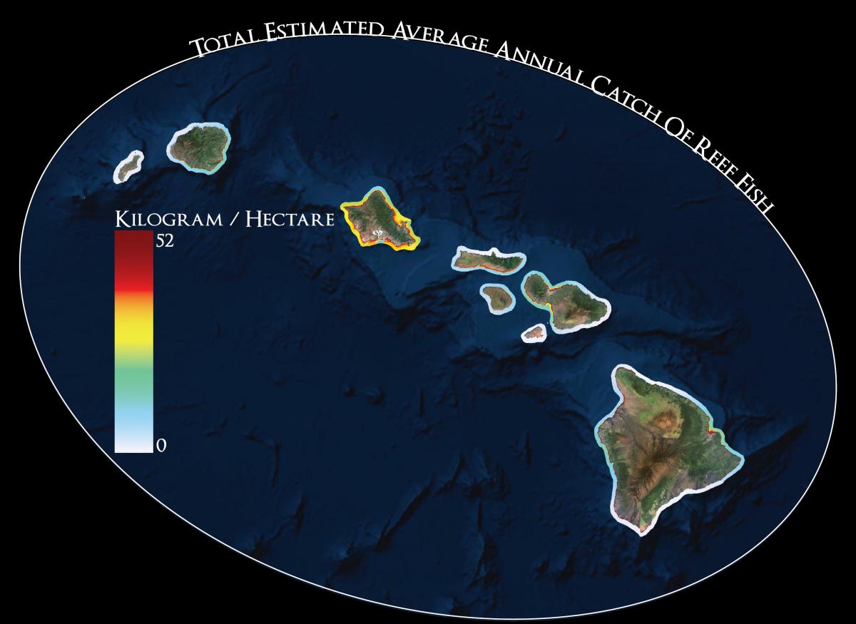
Example data layer representing total average annual reef fish catch (commercial and recreational/subsistence). For more details and to download datasets go to the Ocean Tipping Points project page on PacIOOS.
Not surprisingly, levels of many human impacts are highest on Oahu, including habitat modification, invasive species, and boat-based fishing pressure. Sedimentation and nutrient runoff are the dominant influences in specific locations on Maui, the Big Island, and North Shore of Oahu. The analysis of environmental drivers showed strong variation in productivity and mixing across the archipelago related to coastline shape and orientation.
With an integrated and comprehensive picture of how both human and environmental drivers of coral reef health vary in space across the Hawaiian Archipelago, managers can start to prioritize places and management actions. You can explore the maps interactively in our storymap, and the datasets are publically available on PacIOOS for download.

